


03 Christmasville Voting District, Carroll County, Tennessee
About
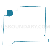
Outline

Summary
| Unique Area Identifier | 668075 |
| Name | 03 Christmasville Voting District |
| County | Carroll County |
| State | Tennessee |
| Area (square miles) | 14.06 |
| Land Area (square miles) | 14.05 |
| Water Area (square miles) | 0.01 |
| % of Land Area | 99.95 |
| % of Water Area | 0.05 |
| Latitude of the Internal Point | 36.08477600 |
| Longtitude of the Internal Point | -88.62267560 |
Maps


Graphs
Select a template below for downloading or customizing gragh for 03 Christmasville Voting District, Carroll County, Tennessee


Neighbors
Neighoring Voting District (by Name) Neighboring Voting District on the Map
- 02 Gleason Community Building Voting District, Weakley County, TN
- 02 Trezevant Voting District, Carroll County, TN
- 03 Greenfield Park Pavilion Voting District, Weakley County, TN
- 11-27 Skullbone Voting District, Gibson County, TN
- 17 Senior Citizens Voting District, Carroll County, TN
Top 10 Neighboring County Subdivision (by Population) Neighboring County Subdivision on the Map
- District 11, Gibson County, TN (4,087)
- District 2, Weakley County, TN (3,978)
- District 3, Weakley County, TN (3,710)
- District 2, Carroll County, TN (2,738)
- District 8, Carroll County, TN (2,636)
Top 10 Neighboring Unified School District (by Population) Neighboring Unified School District on the Map
- Weakley County School District, TN (35,021)
- McKenzie Special School District, TN (7,421)
- West Carroll Special District, TN (7,163)
- Bradford Special School District, TN (3,544)
Top 10 Neighboring State Legislative District Lower Chamber (by Population) Neighboring State Legislative District Lower Chamber on the Map
Top 10 Neighboring State Legislative District Upper Chamber (by Population) Neighboring State Legislative District Upper Chamber on the Map
Top 10 Neighboring 111th Congressional District (by Population) Neighboring 111th Congressional District on the Map
Top 10 Neighboring Census Tract (by Population) Neighboring Census Tract on the Map
- Census Tract 9623, Carroll County, TN (4,672)
- Census Tract 9685, Weakley County, TN (4,613)
- Census Tract 9686, Weakley County, TN (3,710)
- Census Tract 9674, Gibson County, TN (3,635)
- Census Tract 9622.01, Carroll County, TN (3,183)